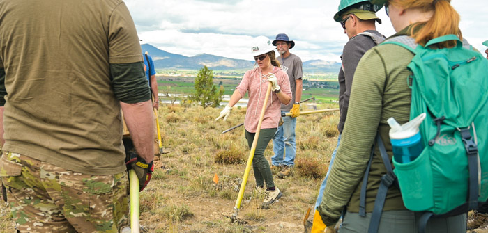
(Amber Toomey and Kim Daniels | Photo courtesy of Central Oregon Trail Alliance)
Prineville walkers, hikers and mountain bikers are celebrating the town’s newest trails with the 66 Trails on the south side of Highway 126 now open to the public following a special ribbon-cutting event today at 4pm.
The 66 Trail System, which straddles Highway 126, started as a small network of just three trails totaling 2.5 miles of single track. The expanded 66 Trail System, which opens today, adds approximately 10 miles of trail with the addition of two unique trails designed for a wide variety of users. The 66 Trail System north of Highway 126 is currently under construction and is scheduled to open in late fall 2019 or early spring 2020.
The expansion of the 66 Trail System was made possible by support from (COTA), Facebook, Crook County, Judge Seth Crawford, Crook County Parks and Recreation and the Oregon State Parks. To date, COTA has put more than 5,000 hours of volunteer work into the trail system.
New Community Trails Serve a Wide Range of Users
The new Upper and Lower 66 Trails are designed with ease of use in mind. The first trail, which is one mile each way, is double-wide and follows a very easy slope, making it accessible for easy walking and cycling. The second gravel trail, which is 1.8 miles each way, is four feet across and is nearly flat, making it perfect for an easy stroll for users of all ages, as well as families with strollers. It will also feature natural benches for resting along the way. There are new kiosks with maps at both the top and bottom of the trailhead, as well as picnic tables.
These two new trails join the existing single-track trails, which were built with mountain bikers in mind and range in difficulty from green to black.
The next section of the 66 Trail System under development, on the north side of Highway 126, will include a five-mile (one way) single-track trail following the cliff’s rim and providing mountain bikers with a technical, rocky, mostly flat ride, plus a wider trail that runs parallel to the single track for hikers and trail runners. Additionally, there will be two mountain bike skills pods.
When fully completed, the 66 Trail System will provide 20 miles of in-town trail access. “These new trails are a fantastic addition to Prineville’s outdoor recreation opportunities, and we can’t wait to see them used by the community, from families pushing strollers on a Sunday afternoon, to senior walking groups, to mountain bikers who want to ride from their home,” said Amber Toomey, former Crook County chapter representative for COTA and current volunteer. “We’re so grateful to everyone who helped make it a reality, from the Facebook Community Action Grants that kicked them off, to the support from the city, county, Parks and Recreation and the Oregon State Parks. And of course, none of this would have been possible without all of our volunteers and their hours upon hours of trail building.”
There is currently no address for this trailhead. Please see directions below.
DIRECTIONS
From downtown Prineville, go east on Highway 126.
At the roundabout, turn right on Tom McCall Road.
Take the first left on SW High Desert Drive.
Follow SW High Desert Drive until it makes a sharp right turning into SW Baldwin Road.
Just before the turn, go IN the exit for the Apple Data Center and take an immediate left onto the gravel road.
Follow the gravel road to the end, where you will find the trailhead sign for the Upper 66 Trail.


