
(Photo courtesy of Visit Central Oregon)
One of Central Oregon’s biggest summer tourism challenges can be wildfire smoke, which may be minimal (remember 2025?) or significant (remember 2020?) depending on regional conditions. A bigger obstacle is the perception that the region is blanketed in unhealthy air all summer long.
That perception has tangible economic consequences. Visitors often delay booking trips until the last minute, weddings are postponed or relocated, and businesses can lose revenue even when large portions of the region remain smoke free.
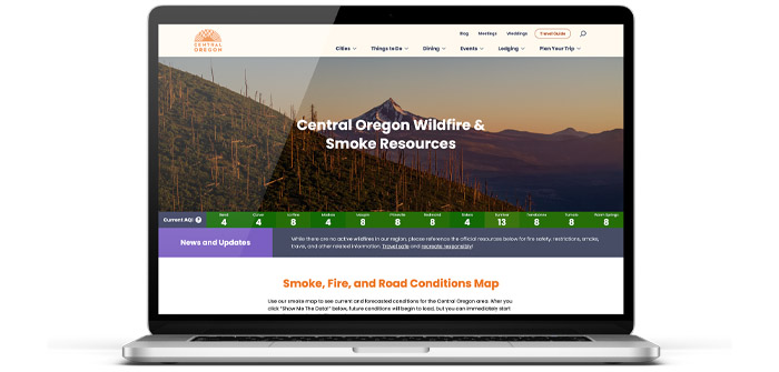
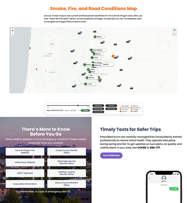
The tourism advocates at Visit Central Oregon hope a new interactive smoke map will help change that narrative by giving visitors and residents real-time information about smoke conditions, active fires, road closures and forecasts, allowing travelers to make informed decisions rather than canceling trips.
The map is available online at visitcentraloregon.com/vacation-planning/resources/fire-information.
According to Scott Larson, president and CEO of Visit Central Oregon, the online resource represents a shift from reacting to wildfire impacts to proactively managing tourism despite a changing climate. “Central Oregon faces the challenge that smoky summers in prior years have created, which has led to the perception today that it is always smoky during certain months,” Larson said. “This has impacted visitation trends … Our hope and vision for the map is that it provides users with real time tools and insights to make informed decisions about their trip plans while redirecting them to other options during the trip if it is smoky.”
Supplying Real-Time Information
Rather than presenting smoke conditions as a regional issue, the interactive map allows travelers to see localized conditions throughout Central Oregon. Because smoke can vary significantly from one community or recreation area to another, Larson believes visitors can often adjust their plans instead of abandoning them.
“We believe that Central Oregon is a world-class destination, and we are fortunate to have so many amazing things to do all across the region,” Larson said. “We also understand that many of our businesses depend on a strong tourism season, so cancellations due to smoke can be very impactful to our communities and local businesses.”
Instead of canceling an entire vacation, visitors may simply choose a different trail, golf course or community with better air quality that day.
“Our goal is to empower people with the tools needed to redirect their trip rather than cancel it,” Larson said. “For example, it may be smoky in one part of the region but not another, which allows us to offer other equally amazing places to hike, bike, or golf. If outdoor options become inhibited by smoke, we have also invested significantly in ways to redirect visitors to indoor activities and things to do, ensuring that we support a strong summer tourism economy.”
Supporting Local Businesses
Tourism remains a major economic driver across Central Oregon, particularly during the summer months. When visitors stay home because of assumptions about smoke conditions, the impact extends well beyond hotels, restaurants, shops and recreation providers. Local governments also feel the effects through reduced transient lodging tax (TLT) revenue.
“We understand how many businesses and communities depend on a strong summer tourism season, so it is crucial that we do what we can to support that for them,” Larson said. “We also know that millions of TLT dollars generated by visitors support public safety, including the (Deschutes County) Sheriff’s Office and some of our local police. Any downturn in visitation limits our ability to pay for local services.”
Larson added that improving access to accurate information is increasingly important as wildfire seasons evolve.
“Making sure that visitors have the tools needed to make informed decisions based on data rather than perceptions is key to supporting what may become the new normal for our summer tourism season.”
Safety is Top Priority
While the smoke map is designed to encourage informed travel decisions, Larson emphasizes that visitor safety remains the organization’s highest priority. Visit Central Oregon sees its role as helping amplify information already being provided by emergency management agencies.
“Without question, safety comes first and is paramount,” Larson said. “To be very clear, we don’t view this tool as something that displaces resources like local and statewide law enforcement.”
Those using the website can also access links to emergency text alerts and additional public safety resources.
“Striking the balance between encouraging visitation while equipping visitors with the needed tools is a nuanced balancing act, though,” Larson said. “On the page referenced on our website, you’ll notice that in addition to the map, we also link out to ways to sign up to text alerts if there is a fire, and we are working to integrate things like the Genasys Protect app at the request of our land management partners. Our goal is to ensure visitors can enjoy their stay while knowing how to find those resources if needed and understanding that their safety concerns are covered.”
The proactive approach has already attracted attention from other Western tourism organizations.
“We’ve spoken to destinations in Utah, Colorado, and California about how they can use this tool for their destinations and it has had great support from partners within our region as well,” Larson said. “We have been excited to see such a positive response to the tool, and we are hopeful that it will continue to be useful for other destinations who are dealing with similar challenges.”