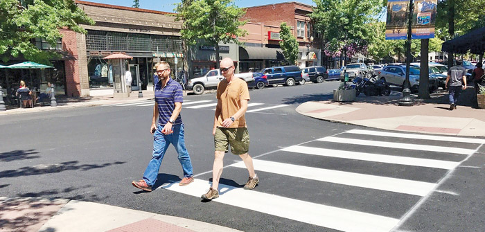
The winter wind and cold is finally over. Meaning: it’s time to start bike commuting. Commuter bike trails are all over and around Bend; in fact there are 62 miles of paved and unpaved trails open to the public. It’s just a matter of reading road and trail maps (and maybe a little exploration) to find the most direct route from home to work and back.
If you haven’t already explored the possibilities, you’ll be surprised at the provisions out there for bike commuters. Planning managers at the City of Bend and Bend Park and Recreation District have an ongoing commitment to increasing bicycle ridership in Bend by providing safe and convenient bike facilities and maps to them.
“The idea of raising non-automobile mode share is not some blue-sky fantasy of a transportation planner’s whimsy but a requirement of Oregon’s landmark land use laws. As a designated metropolitan planning organization (MPO), the Bend urban area must strive to lower what is referred to as vehicle miles traveled (VMT) over the course of the next twenty years,” said Rick Root, transportation planner for the City of Bend.
Now there’s a law that will benefit everyone. Bike commuters will get better, safer routes to travel on. Non-bikers stand to benefit too, with the cleaner air and decreased congestion which results when more people get out of their cars.
According to Steve Jorgensen, planning manager for Bend Park and Recreation District, 90 percent of Bend’s arterial streets have bike lanes. In addition, many neighborhood streets are bike friendly because of the lack of real traffic along them. If bike commuters combine official bike lanes and trails with creative connectors, it can make their bike commute as fast (or even faster) as one by car.
But bike commuting isn’t just about speed. The Deschutes River Trail on Bend’s west side and Larkspur Trail on the city’s east side can be accessed at many points along the way, making for a scenic and enjoyable commute. “There’s nothing technical to these trails,” said Jorgensen.
“People just need to know where they need to go, and how to use the tools on our website,” said Jorgensen. “Figure out what works for you. It’s not always a bike lane. Be creative and find ways to get away from traffic on your commute.” A hard copy of Bend Park and Recreation District’s trail system map is available at various locations around town. The map is also on their website at www.bendparksandrec.org/Parks__Trails/trail_List/.
“There really are a lot of facilities out there, both on and off-street, that people may not be aware of,” said Root. “And with improved knowledge, it might ‘tip the scales’ toward seriously considering a bike trip in-lieu-of a car trip, particularly a work trip. Or at least it might peak their curiosity about exploring some areas of the city (by bike) that they have otherwise not seen or enjoyed.”
For online City of Bend maps that illustrate a mixture of existing and planned facilities that include bike lanes, trails and other convenient road corridors (or short cuts), visit www.ci.bend.or.us/gis_and_mapping/docs/Bike_Trails_TSP.pdf.
For enlargements of the four quadrants of the city, visit www.ci.bend.or.us/depts/community_development/planning_division_2/transportation_system_plan.html and scroll down to Resource Documents.
Commute Options promotes choices that reduce the impacts of driving alone. For more information about Commute Options, contact Jeff Monson, Executive Director of Commute Options at 541-330-2647 or visit www.commuteoptions.org.
Annissa Anderson is a freelance writer and PR consultant in Bend.
What’s Coming to Bend’s Bike Trails
Bend Park and Recreation District has a number of projects slated for this summer that will improve sections of Bend’s existing bike trails:
Deschutes River Trail
A just-completed section of trail just north of Pioneer Park will connect to the Deschutes River Trail via a new bike and pedestrian bridge to cross the Deschutes River near the 1st Street Rapids.
Larkspur Trail
An extension and paving of trail near Pilot Butte will connect the parking area at Pilot Butte State Park up to Neff Avenue.
Coyner Trail
A section of this trail will be upgraded from Ponderosa Park past the skate park, around Bear Creek Elementary and ending at Juniper Park.


